 |
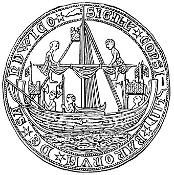
| Seal of Sandwich 1238 |
Sandwich was one of the main Cinque Ports. It was a fief of the Archbishops of Canterbury and was used by Becket to make good his secret escape to Flanders after the council of Northampton in 1164. And also for his return from exile in 1170. The people of Sandwich were his men, and owed fealty to him.
Very likely in Becket's time it was involved in the North Sea herring trade, and the people of this region of England were Men of Kent. It always had many small boats, especially fishing ones, ready for cross-channel traffic.
In 1023 it is alleged that king Cnut granted the monks of Christ Church, Canterbury, the tolls of the port of Sandwich and all the landing place and water dues on both sides of the Wantsum channel [River Stour] along with half of any clothes, nets, weapons, iron, gold or silver found on the western shore of the Wantsum.
Sandwich [Sandvika] was an important channel port during the Middle Ages. For a very long time. however, the whole area has been silting up with sands, and the river channel of the long reach of the River Stour which led from the sea by Pepper Ness to Sandwich town is not as deep and wide as it once was. The land around Sandwich is low lying marshland liable to flooding, a kind of fenland, some of which has been deliberately reclaimed. For example there is the Monk's Wall constructed by the monks of Sandwich to reclaim land from the river and sea in the 13th Century. The port of Sandwich was known as Sandwich Haven [Portus Sandvicensis].
References
English Channel: Kent and Pas de Calais http://bit.ly/1pwDMq9
Wikipedia Sandwich (Kent)
Wikimapia Sandwich and Eastry
http://wikimapia.org/#lang=en&lat=51.274696&lon=1.338959&z=13&m=b&v=8&tag=46520&show=/5301893/Eastry
1023 - Charter for the Grant by king Cnut to Christ Church, Canterbury, the port of Sandwich.
Académie des inscriptions et belles-lettres, Paris; Its (1815). Mémoires. pp. 198–9.
Caius Plinius Secundus (maior); Ajasson de Grandsagne (1829). Histoire naturelle de Caius Plinius Secundus. Panckoucke. pp. 332–3.
Saxon Shore Way - Wikipedia
Samuel Lewis (1831). A Topographical Dictionary of England: Kent: S. Lewis. pp. 500–.
Stuart Fisher (5 January 2012). Rivers of Britain: Estuaries, Tideways, Havens, Lochs, Firths and Kyles. Bloomsbury Publishing. pp. 243–. ISBN 978-1-4081-5583-7.
The History and Topographical Survey of the County of Kent: Volume 10 (pp. 152-216)
The town and port of Sandwich
Christopher Packe (1743). Ankographia, Sive Convallium Descriptio. In which are Briefly But Fully Expounded the Origine, Course and Insertion; Extent, Elevation and Congruity of All the Valleys and Hills, Brooks and Rivers, ... of East-Kent. ... By Christopher Packe, M.D.. J. Abree, for the author.
StudyLight.org.
A Handbook for Travellers in Kent and Sussex: With Map. Murray. 1858. pp. 202–.
Oscar Baker (1848). History of the Antiquities of Sandwich and Richborough Castle in Kent. pp. 1–. & pp. 8-9.
Joseph Priestley (1831). Historical Account of the Navigable Rivers, Canals, and Railways of Great Britain: As a Reference to Nichols, Priestley & Walker's New Map of Inland Navigation,. Canterbury Navigation or River Stour: Longman, Rees, Orme, Brown & Green. pp. 131–.
Joseph Priestley (1831). Historical Account of the Navigable Rivers, Canals, and Railways of Great Britain: As a Reference to Nichols, Priestley & Walker's New Map of Inland Navigation,. Canterbury Navigation or River Stour: Longman, Rees, Orme, Brown & Green. pp. 131–.
William Boys (May 2010). Collections for an History of Sandwich in Kent with Notices of the Other Cinque Ports and Members, and of Richborough by William Boys, Esq F a S. BiblioBazaar. ISBN 978-1-140-81716-1.
Town Plan of Sandwich 1787
 |
| Town Plan of Sandwich 1787 |
1911 Encyclopedia Britannica
Sandwich
Edward Hasted. "Parishes: Eastry." The History and Topographical Survey of the County of Kent: Volume 10 (1800): 98-121. British History Online.
Wantsum Channel
Eastry
British Historical Documents: Life of Thomas Becket (Gervase of Canterbury)
Richard Brooks (2014). The Knight Who Saved England: William Marshal and the French Invasion, 1217. Osprey Publishing. pp. 261–. ISBN 978-1-84908-550-2.
Wantsum Channel
Richborough Castle
http://www.english-heritage.org.uk/daysout/properties/richborough-roman-fort-and-amphitheatre
William Somner (1693). A Treatise of the Roman Ports and Forts in Kent: To which is Prefixt the Life of Mr. Somner. J. Brome.
William Somner (1693). A Treatise of the Roman Ports and Forts in Kent: To which is Prefixt the Life of Mr. Somner. J. Brome.
Isle of Thanet
Edward Hasted. "The island of Thanet: Introduction." The History and Topographical Survey of the County of Kent: Volume 10 (1800): 217-237. British History Online.
http://www.british-history.ac.uk/report.aspx?compid=63620
Medieval Thanet Archaeology
http://goo.gl/tt63tO
Medieval Thanet Archaeology
http://goo.gl/tt63tO
British War Office GSGS 4369, 8 - Map of the Strait of Dover
Watling Street
 |
| Sandwich 19th century |
 |
| British Library: A Chart of the Isle of Thanet and Sandwich Marsh |
Goodwin Sands

 |
| Sandwich |
 |
| Sandwich |
Isle of Thanet

Isle of Thanet [Thanatis or Tenet] Map Showing the Ancient Course of the River Wantsume Past Stourmouth ca 1550


No comments:
Post a Comment
Note: only a member of this blog may post a comment.